
Beginning in early 2026, I have been heavily focused on mapping tribal people groups and language divisions across the 20+ countries where Gospelink facilitates indigenous missionaries to make disciples and establish Biblically-sound churches. While continuing this work in South America (for nearly 20 years!), I am now applying my investigative mapping skills to uncover the ethnolinguistic landscape of Eastern Africa. Gospelink has been engaged in many of these countries since 1998, the fruit of which has been tens of thousands of churches planted across this region alone.
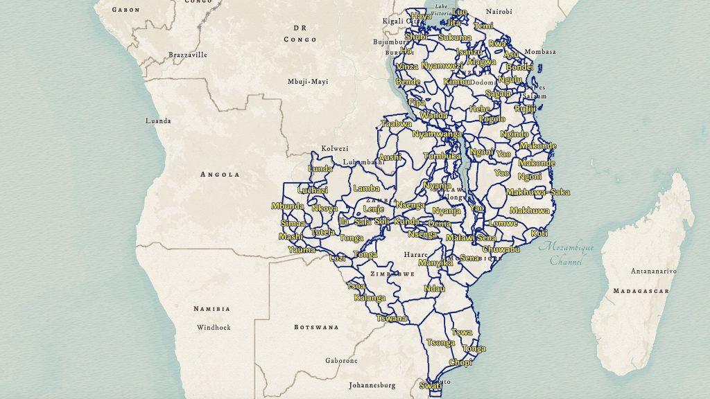
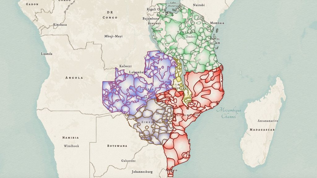
Within just these five countries, Malawi, Mozambique, Tanzania, Zambia, and Zimbabwe, over 220 native languages are spoken. Not included here is the DR Congo which I have also begun mapping, a vast, conflict-ridden country which alone contains over native 200 languages.
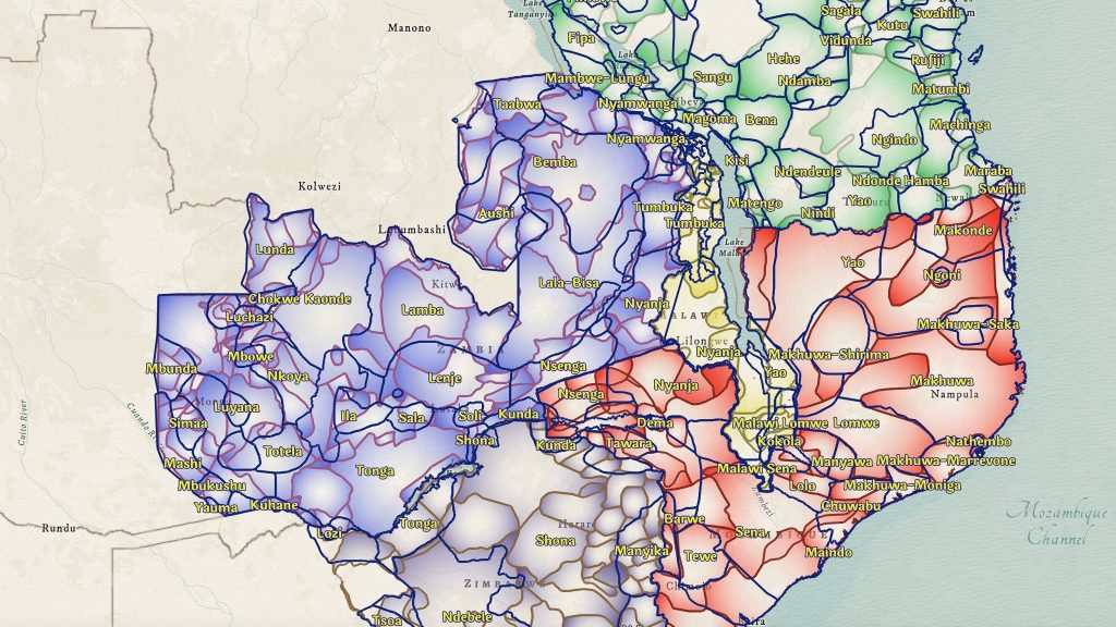
Zooming in shows languages mapped overlayed on top of the tribal group locations. Tribes and languages are not always the same. Sometimes, a tribe will speak multiple languages; other times, one language might be shared among multiple tribes. Oftentimes, tribes are further subdivided into sub-tribes (and clans) from a larger group, in which case dialects are common. Clear distinctions between the tribes and their languages are most evident in the rural areas. The closer you get to urban spaces, especially large towns and cities, the more varied the composition becomes. Urbanized people will often communicate in a national language such as Swahili, English, or in the case of DR Congo, French, while still retaining their native tongue. The ethnolinguistic landscape is thus quite complex, making the process of defining the locations of each tribe and language a challenge.
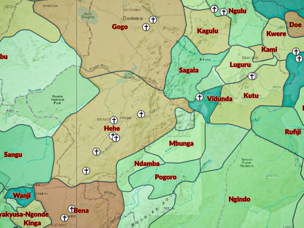
With much of the ethnolinguistic landscape defined in these countries, I recently began mapping the locations of churches planted by Gospelink partners in each one. This itself has proven challenging, starting with tracking down reports of churches planted over the years. These reports are typically hand-written and often present mere ‘clues’ about church locations. Fortunately, I am comfortable using a GIS in which I add location data from many sources. Relief and humanitarian NGOs, government agencies, and academic papers all contribute to this process. Data availability from one country to the next also varies. Though a slow process, I have managed to identify where many of these churches are located down to the town or village level. Fortunately, the church reports also include information about the tribes served and languages used, further refining the map of tribal locations.
This work adds great impact to the ministry. As distinctions between tribes and languages are clarified, the maps serve to improve and expand the ministry. I am grateful to assist Gospelink in this way, creating an overall picture of where the ministry has taken root, which tribes are being ministered to, while identifying gaps to explore further.